
Coordinates only
The output consists of latitude and longitude coordinates, each with a confidence score. There are no reports to interpret or subjective conclusions to evaluate.
A proprietary mathematical algorithm applied to earth data. It returns a ranked list of points, across natural resources such as oil & gas, gold, silver, tungsten, copper, lithium, and more.
About Us
A targeting system for natural resources. It takes a licence block, a basin, or a whole region, and returns the points inside it that are worth testing first.
It carries no geological opinion, and it does not reprocess seismic data. The output is a coordinate, nothing more, and a coordinate can be tested.
Where a known, confirmed location sits inside the area, the system lands on it with high precision, despite having no prior knowledge of it, and it produces that known point in the very same run as every unknown one. Oil and gas, gold, and silver have all proven this out. Tungsten, copper, and REE are underway.
The method
The algorithm is evaluated by its results.
The internal workings of the algorithm are proprietary and are therefore not publicly disclosed. That includes the inputs it uses, the processing, and the criteria it applies. Rather than asking anyone to accept claims about how it works, we invite objective testing of its results.
The output consists of latitude and longitude coordinates, each with a confidence score. There are no reports to interpret or subjective conclusions to evaluate.
The coordinates are ranked in order of priority, allowing testing to begin with the highest-confidence target.
Select an area where the outcome is already known but has not been disclosed to us. The algorithm is run independently, and its results can then be compared against the known outcome.
Programmes
One algorithm, applied across natural resources. Each programme has been run against ground where the answer was already confirmed.
Run across the Orange Basin off Namibia, home to three of the largest confirmed discoveries of the last decade. All three returned. Nothing false. Offshore, rig positions are chosen for company convenience, not geology, and are almost never located above the actual wellhead. A result near a rig is not measured against an arbitrary marker. It stands independent of where the rig happens to sit.
Request the results ↗Run across Nevada, California and Alaska, and scored against the locations of known producing mines.
Request the results ↗Underway now. The same algorithm, applied to a different mathematical signature.
View the map ↗ Request the results ↗Underway now. The same algorithm, applied to a different mathematical signature.
View the map ↗ Request the results ↗Underway now. The same algorithm, applied to a different mathematical signature.
View the map ↗ Request the results ↗Underway now. The same algorithm, applied to a different resource.
View the map ↗ Request the results ↗Underway now. The same algorithm, applied to a different resource.
View the map ↗ Request the results ↗Using proprietary mathematical modeling, we identified rare earth (REE) and tantalum targets in various locations.
Neodymium, Praseodymium, Dysprosium, Tantalum
Request the results ↗GeoVENA is a proprietary mathematical framework for natural resources exploration, developed over many years of research, development, and continuous refinement.
Because the system represents the core intellectual property of GeoVENA, the underlying algorithms, implementation, data processing methods, and mathematical procedures are not publicly disclosed. The purpose of this description is only to provide a general overview of the conceptual framework without revealing the proprietary methodology.
The system models the Earth as a mathematical information space rather than simply as a collection of physical materials. Information from multiple independent data sources (details intentionally not disclosed) is embedded into a unified mathematical representation that allows relationships between different measurements to be analyzed within a single framework.
Instead of relying on conventional geological interpretation alone, the framework searches for stable mathematical structures and relationships that emerge from the combined information. The underlying hypothesis is that these mathematical structures contain patterns associated with natural resource deposits that are not readily apparent in the original measurements.
The framework also constructs a latent mathematical representation derived from the relationships within the combined information. Within this representation, mathematical structures that are not directly apparent in the original data may become identifiable through their organization and correlation. This representation serves solely as a mathematical framework for analysis and should not be interpreted as a claim regarding new physical phenomena or unconventional physics.
GeoVENA produces ranked target coordinates together with confidence scores. The methodology remains proprietary, but the results are objective and independently testable through field validation.
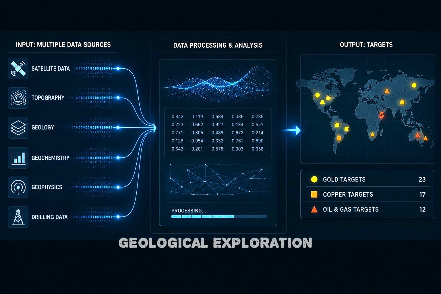

GeoVENA does not rely on prior knowledge of known deposits, drilling locations, geological interpretations, or resource databases as inputs to generate its results. The system is designed to operate independently of existing exploration targets.
It took many years of research, development, and refinement before the system reached a level of accuracy considered ready to be presented and offered to others. Its value should ultimately be assessed by the accuracy of its predictions under independent testing rather than by disclosure of its proprietary implementation.
Note: At the current stage of GeoVENA development, targeting deposits that have been physically displaced from their original point of formation, such as many placer or alluvial occurrences, is less accurate than targeting stationary deposits.
Reference: Anomaly Targetting
One free coordinate, no cost, so you can evaluate the result yourselves.